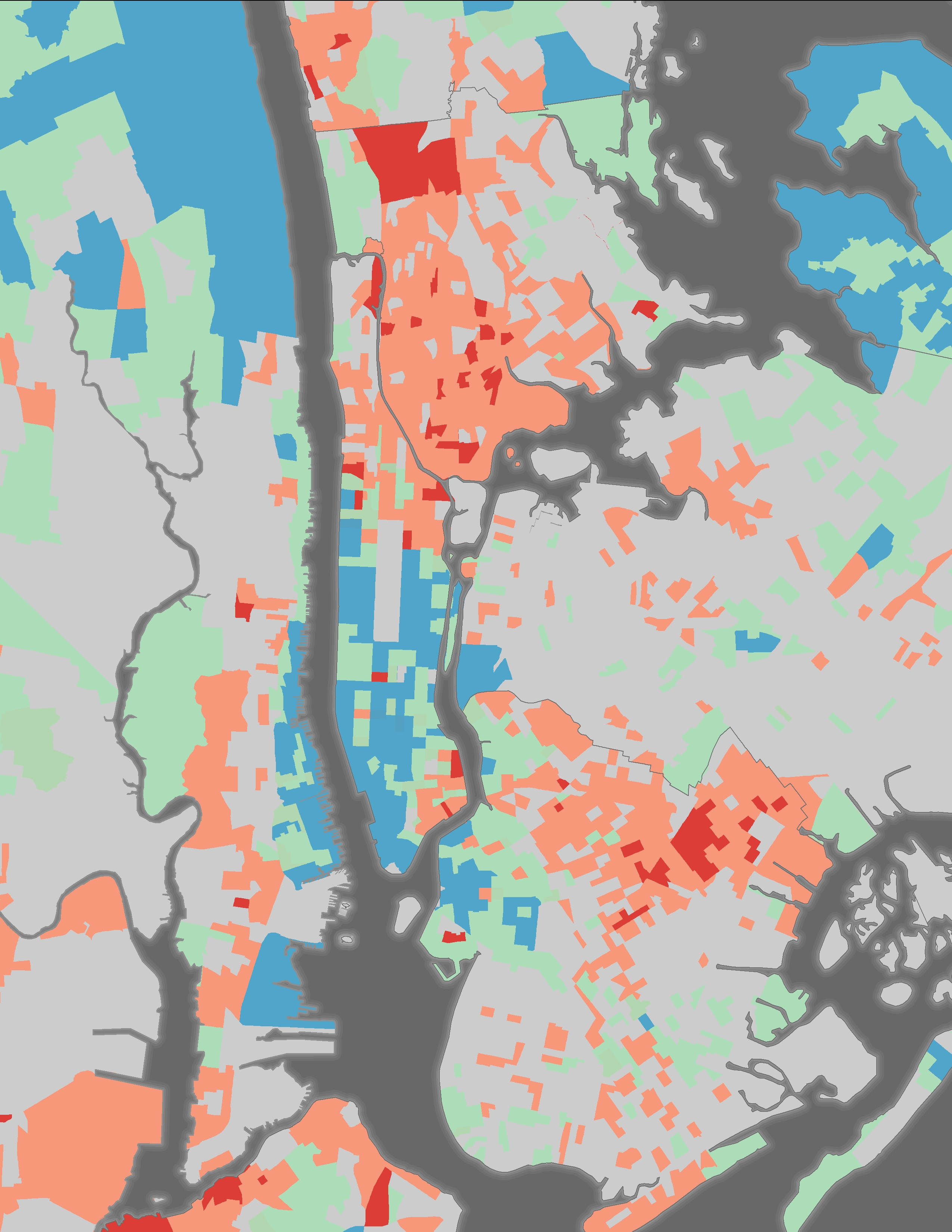
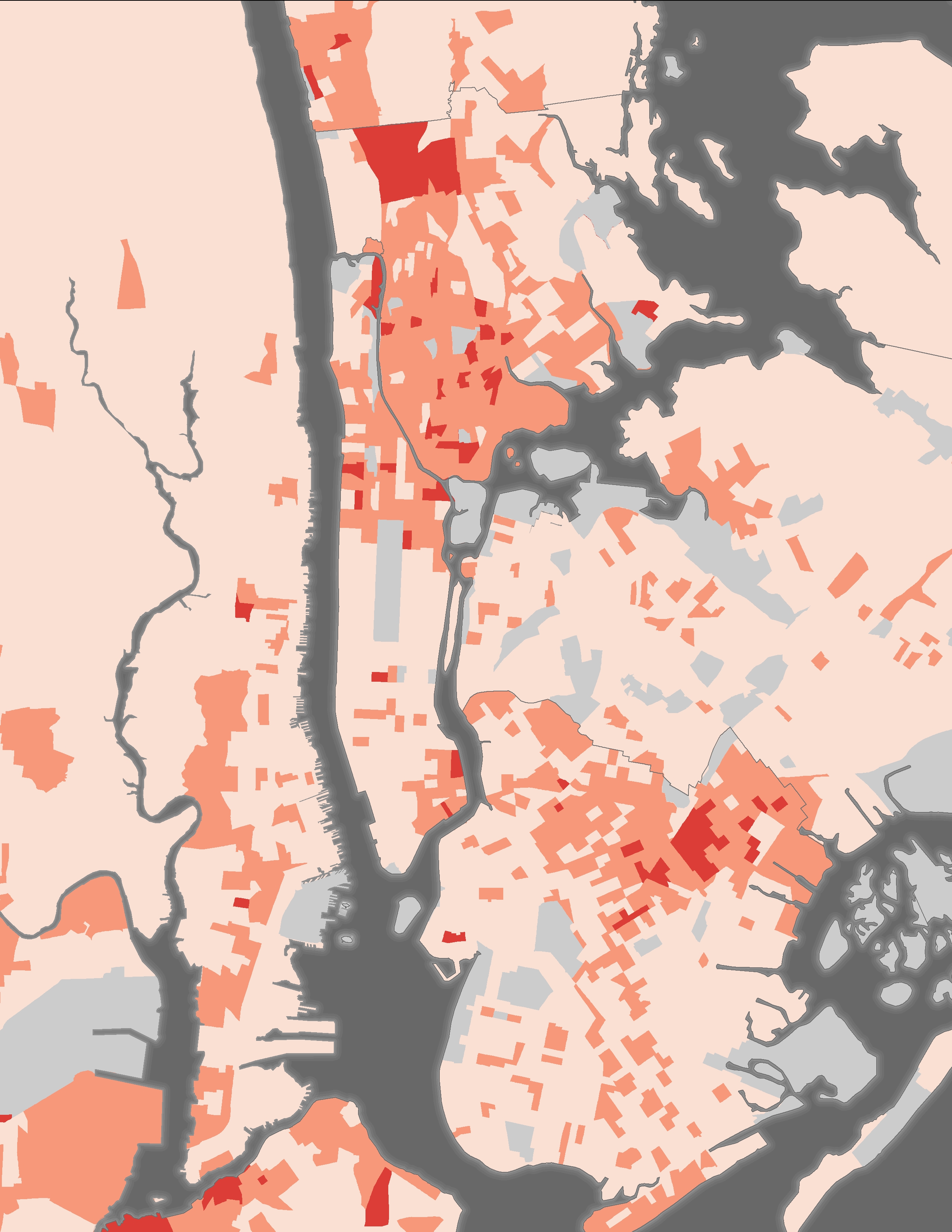
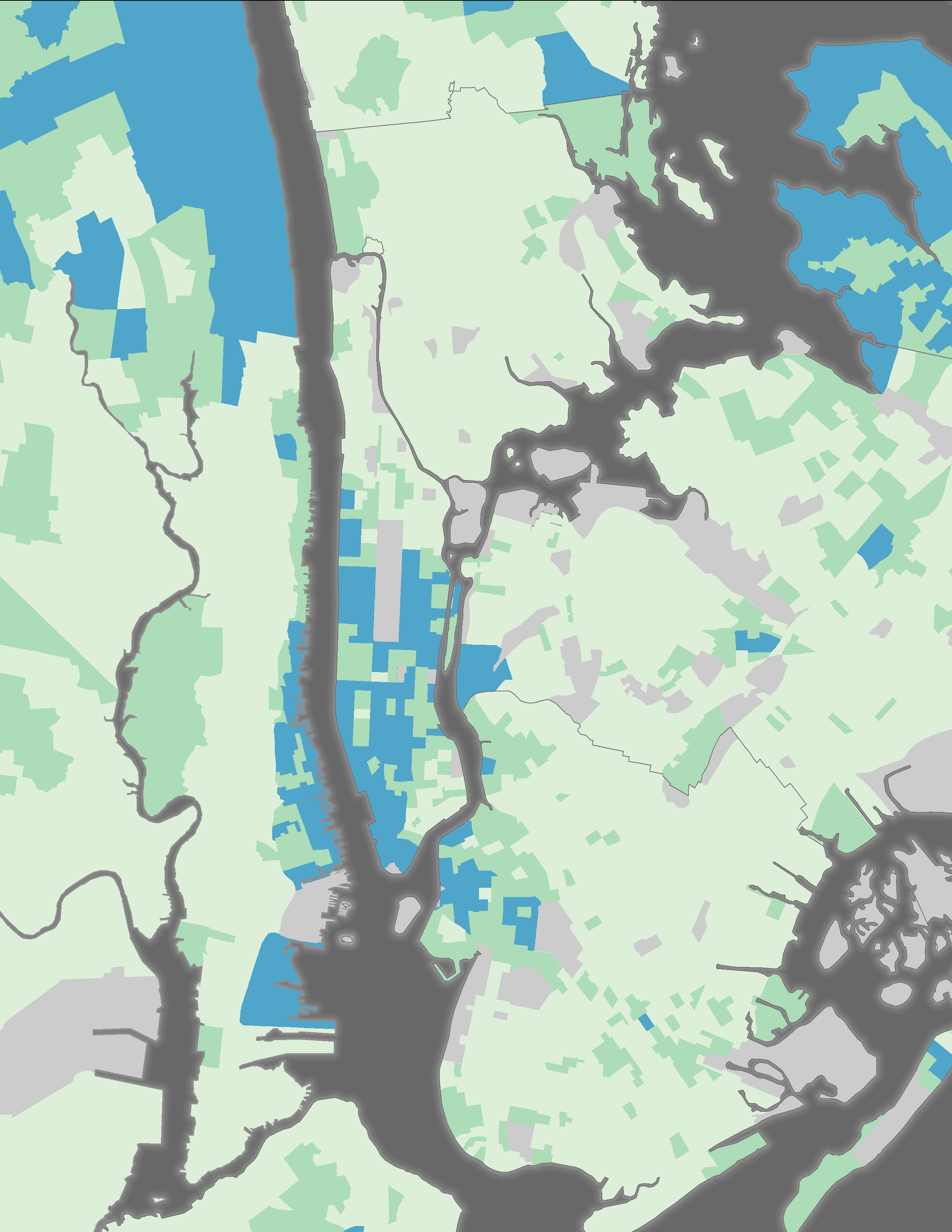
︎︎︎ NYC Metro Area Income Analysis
Using Geographic Information Systems, these maps were created out of a self-directed research project that sought to spatially visualize income inequality throughout the New York City Metropolitan Area. Information management, spatial statistics, and other methods of data analysis were performed on available US Census data to visualize the spatial distribution of wealth in an urban context.